Trail Maps
Check out our printable trail maps or links to Google Maps for driving directions to a trail head near you.
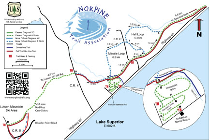
Hall-Massey Loop and connector trails
Click on map for high resolution pdf version of Hall-Massey Loop and connector trails.
We are encouraging dogs on the westbound connector from the snowmobile parking lot trailhead just west of cascade running out and back westbound toward spruce creek and the Hall loop intersection; this is a nice section with good scenery and you all should enjoy the experience. Remember your GIA MN Ski pass.
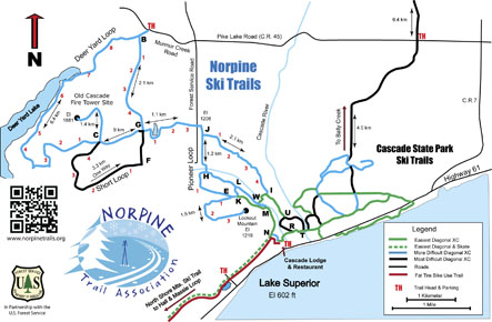
Deer Yard Loop and connector trails
Click on map for high resolution pdf version of Deer Yard Loop and connector trails.
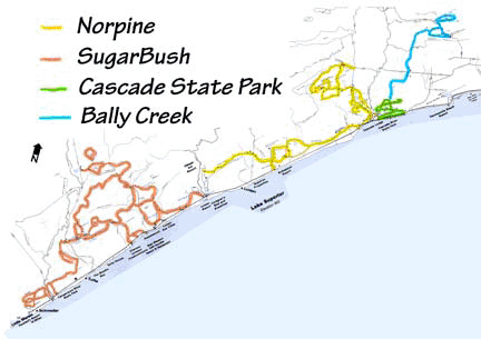
North Shore Trail System
Click on map for high resolution pdf version of the North Shore Trail System.